Kilauea Eruption
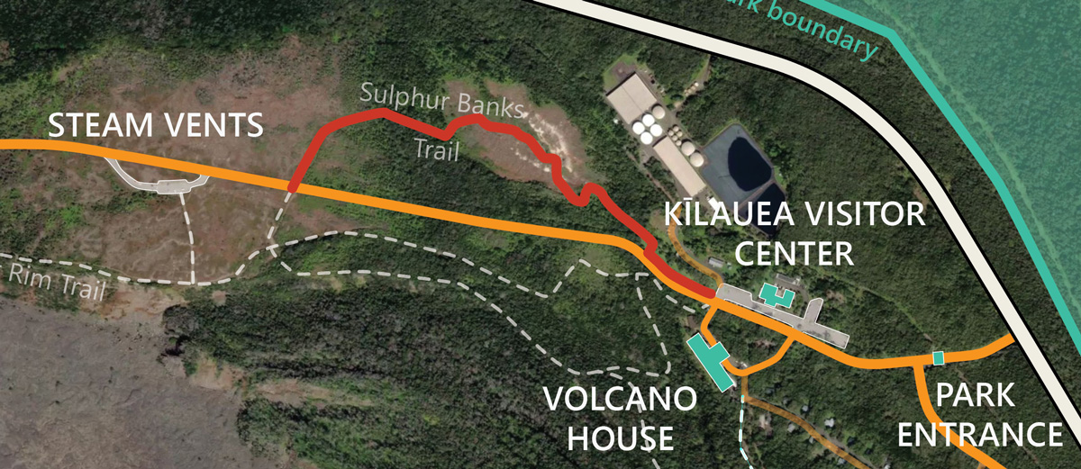
Lava Viewing Map
To aid in your adventures, we have put together a map of the Kilauea crater area with the best, most current lava viewing points. Trails, interest points, as well as other helpful information are highlighted. We recommend downloading or printing it as some remote areas of the Volcanoes National Park can lack phone signal.

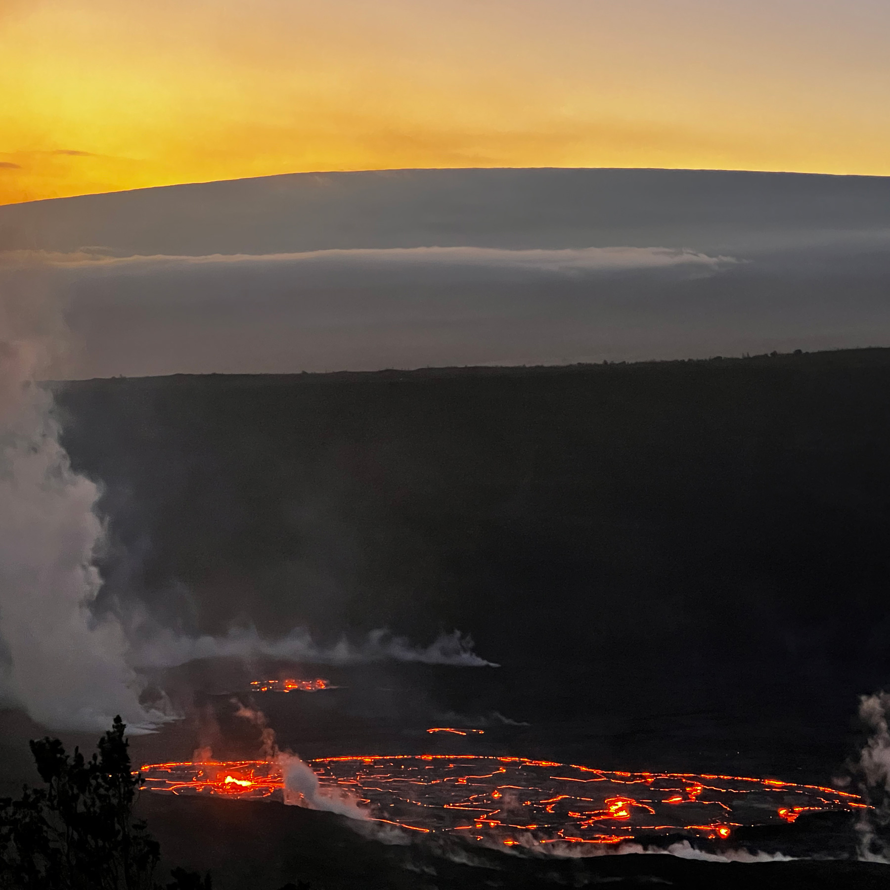
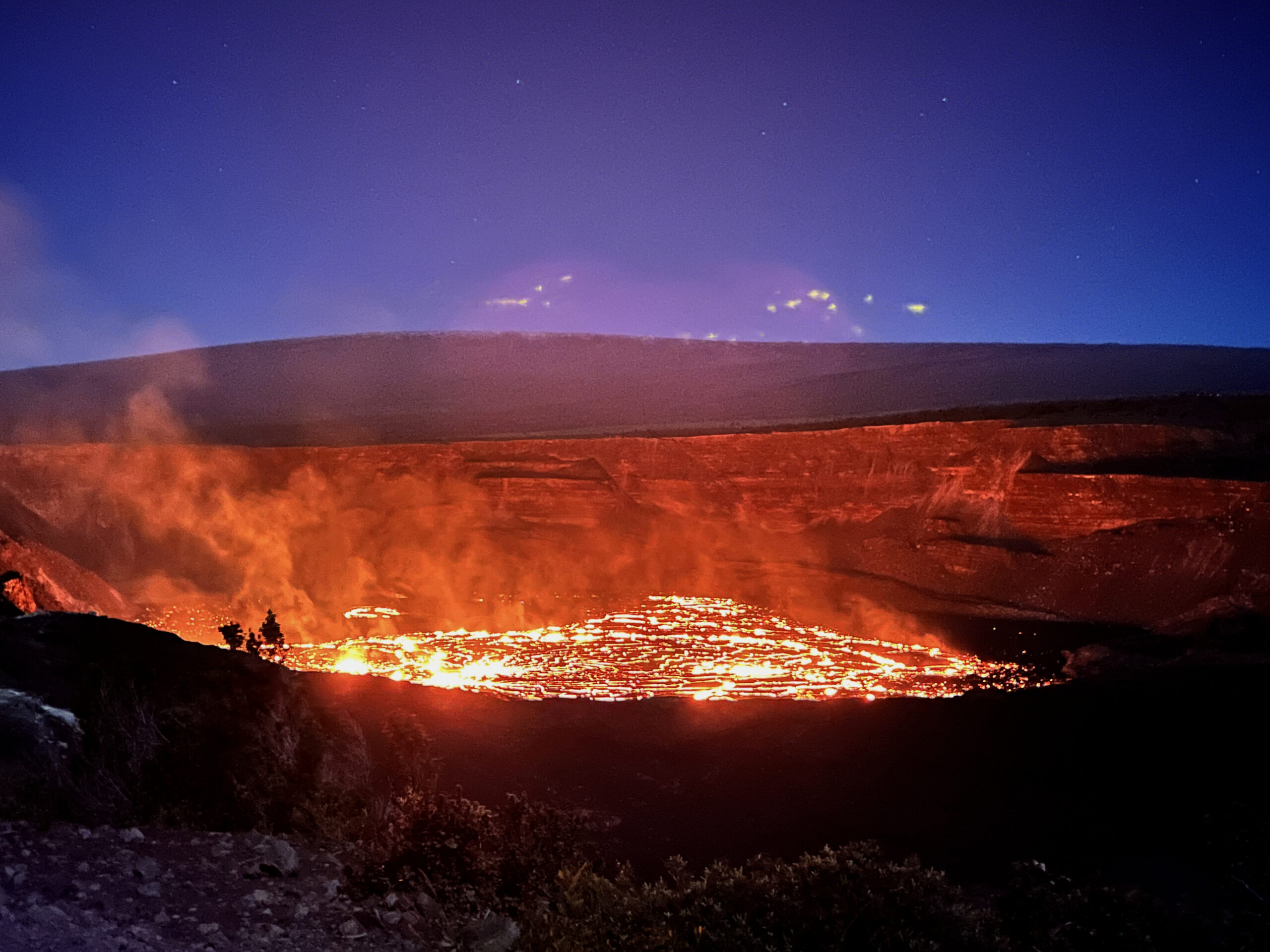
1. Lava Glow watching
Uekahuna / Kilauea Overlook
These two locations are the best and most accessible to see the lava lake. When crowded, you can easily walk along the Crater Rim Trail to find other viewing points. Sunrises are especially breathtaking due to the Eastern orientation.
DIRECTIONS: Park at Uēkahuna, then walk a couple hundred yards to the overlook at the highest point of the caldera. Mostly paved road with some elevation gain. From the Kīlauea Overlook parking lot, walk straight to the viewing area. You can walk along the paved and light-marked Crater Rim Trail.
AMENITIES: Restrooms in both parking lots, 105 parking stalls total, park rangers available during afternoon hours.
Keanakako’i Overlook
The spectacular sunset views and a fantastic night sky make the 2-mile roundtrip worth the effort. Just make sure you beat the crowd
DIRECTIONS: Park at the Devastation parking lot and follow the signs to the viewing area. Most of the road is paved, with the last few hundred yards on gravel.
AMENITIES: Restrooms at trailhead, limited parking of 58 stalls total, park rangers available during afternoon hours.
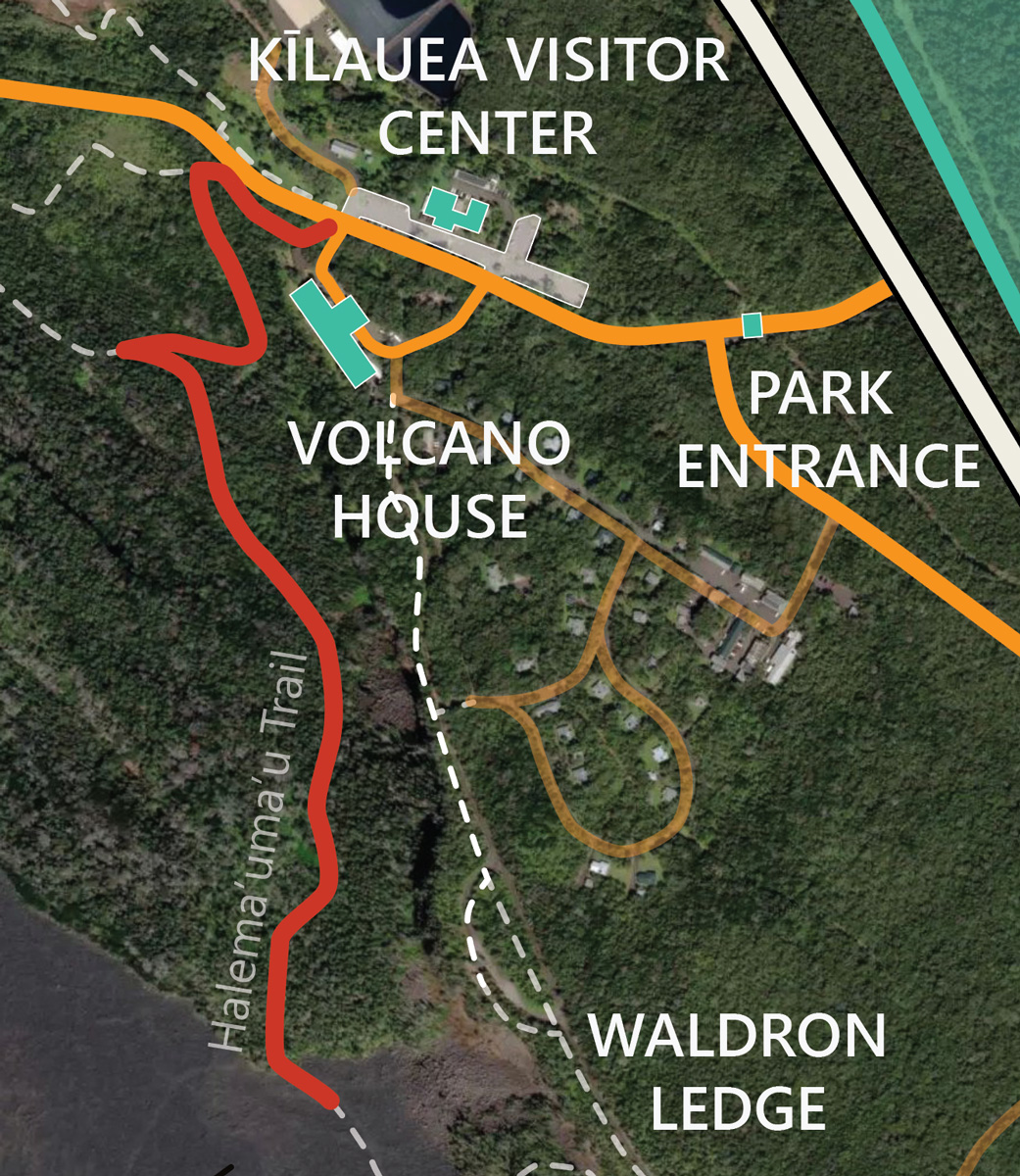
Waldron Ledge Overlook
Panoramic view of the caldera with the lava lake peaking over the crater’s edge. Least crowded viewing location.
DIRECTIONS: Park at the Visitor Center and walk about 400 yards South along the paved Crater Rim Trail.
AMENITIES: Restrooms, 125 parking stalls, picnic area, and Information available at the Visitor Center.

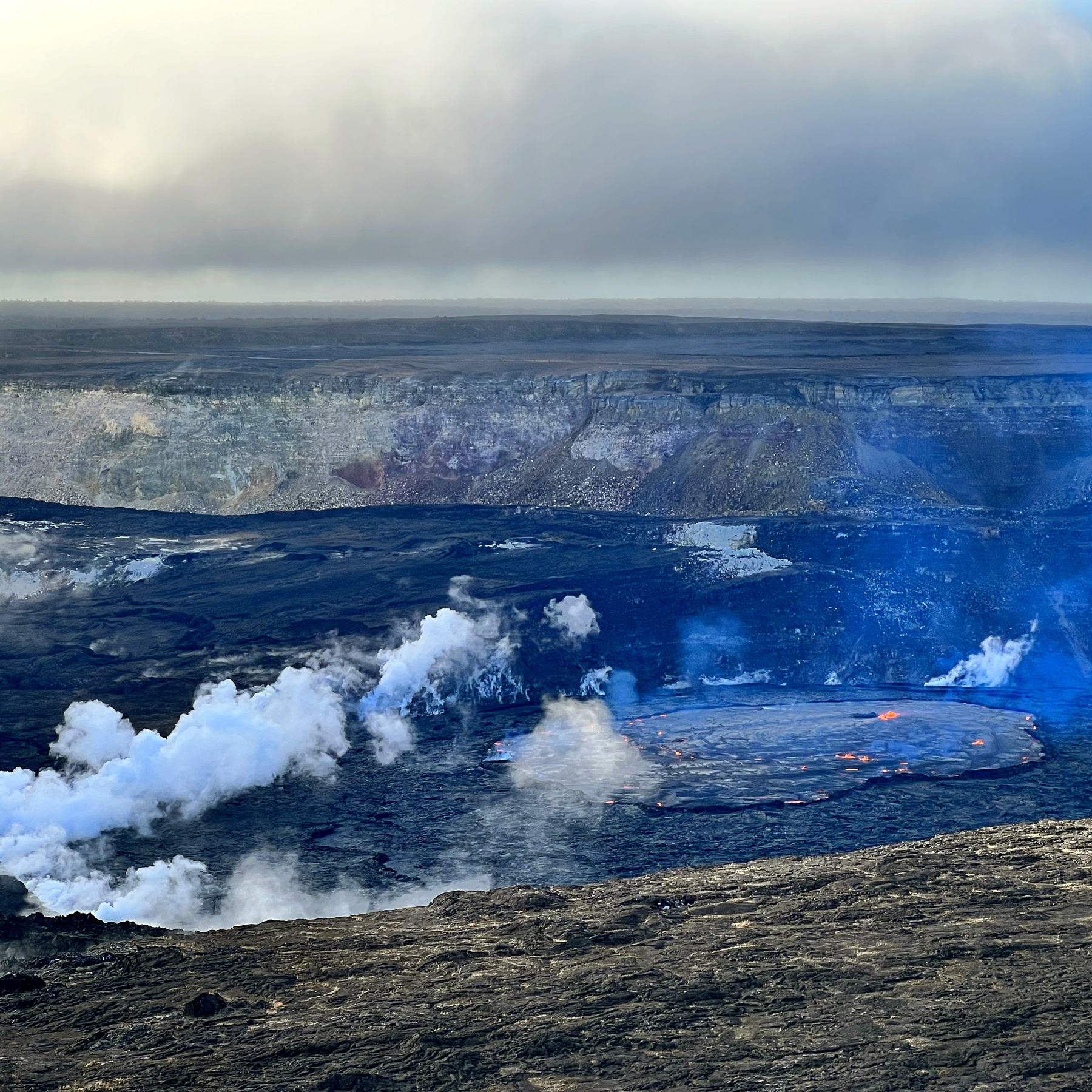
2. Sulfur Banks (Ha’akulamanu) trail
The Sulphur Banks trail offers a truly remarkable sensory experience. Rich yellows from sulfur and dark reds from iron oxide blanket the barren landscape. Unique smells from the volcanic gases rich in carbon dioxide, sulfur dioxide, and hydrogen sulfide fill the air. Steam gently seeps out of the ground engulfing the trails in their warm embrace. The lush rainforest encircling the dramatic volcanic terrain is a bird watcher’s paradise where you can immerse yourself in the chorus of their songs.
The trail starts from the Kīlauea Visitor Center parking lot side near the Volcano Art Center Gallery and ends across the street from the Steam Vents parking lot
3. Halema’uma’u trail
The Halema’uma’u trail is a must within the Volcanoes National Park. Descend 425 feet (130 meters) through a lush rainforest of Ohi’a trees and beautiful Hapu’u tree ferns while listening to the amazing songs of Hawaiian songbirds. At the end of the descent, you will be enchanted by a panoramic view of the crater floor of the Kilauea caldera (Kaluapele) with its unique geological features.
From there, you can continue exploring along the Kilauea Iki or Byron’s Ledge trails all the way to Nahuku (Thurston lava tube) or return to the Visitor Center.
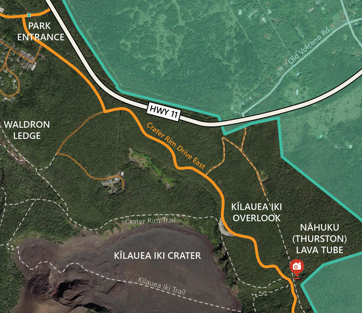
4. Nahuku (Thurston) lava tube
The short, 0.4 mile/0.65 km loop through the rain forest and the lava tube are a must when visiting the Volcanoes National Park. Formed over 500 years ago and discovered in 1913 by Lorrin Thurston, a local newspaper publisher, Nahuku is home to entire microbial ecosystems.
The trail is paved, and the National Park Service installed a lighting system that is on between 10 a.m. and 8 p.m. You must carry your own light sources outside those hours.
Parking here is very limited throughout the day. We recommend visiting before 9 a.m. or after 4 p.m.
5. Devastation trail
Take a quick stroll through a recovering landscape devastated by the 1959 Kilauea Iki eruption. Lava fountains taller than 1000 feet/300 meters have buried this area with falling cinder.
The 1 mile/1.6 km Devastation trail round trip is wheelchair and stroller accessible and should take approximately 1 hour to complete. To access the trail, start from the Devastation parking lot. The Pu‘upua‘i parking lot is currently closed.
The area is also frequented by Nēnē (endemic Hawaiian geese), a threatened species which is also the Hawaii state bird. When fed by visitors, they learn to approach cars, which are the leading cause of death for adult Nēnē in the park. DO NOT FEED the Nēnē.
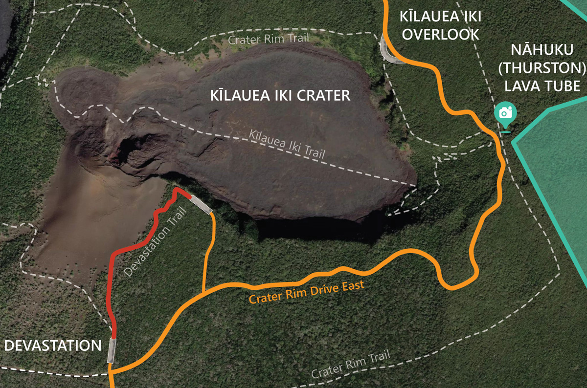
6. Kilauea Iki trail
This popular trail starts along the heavily forested rim of the Kilauea Iki crater, which translates to “little Kilauea”. After a 400 feet/120 meters descent through the rainforest filled with the songs of native Hawaiian birds, you reach the solidified lava bottom of the crater.
On your crossing of the still warm and steaming crater floor, peer into the vent that has erupted in 1959, shooting lava 1900 feet/270 meters into the air and creating the Puʻupuaʻi gigantic cinder cone. The eruption filled Kilauea Iki until it started overflowing in the main Kilauea caldera.
Once you return to the crater rim, you can also visit Nauhuku (Thurston) lava tube on your way back to the Kilauea Iki parking lot.
Be prepared for both hot and dry, as well as wet and windy weather conditions. Hiking sections of the trail can be challenging due to the steep and rocky terrain over the lava flow fields.

7. Kealakomo Overlook
The Kealakomo Overlook offers one of the most stunning views of the southeastern part of the Big Island. Located on the edge of a sloping 2000 feet/600 meters hill to the ocean, it offers unobstructed coastline views. On a clear day, you can see all the way to South Point!
From here, you can get an idea of the magnitude of the Maunaulu lava flows from the 1969-1974 eruption. The darker flows are a’a lava, fast flowing, sharp and rough, while the lighter, silvery, are pahoehoe lava, slow flowing and smooth. With lava fountains reaching 1770 feet/540 meters and lava falls higher than Niagara, it was considered at the time Kilauea’s longest-lasting and most voluminous eruption in the last 2200 years.
Kealakomo Overlook is a great place to stop and have a picnic on your way to the coast below.
The Kealakomo Overlook is located along the Chain of Craters Road, about 13 miles/21 km from the Volcano National Park entrance.
8. Pu’uloa petroglyphs
The Pu’uloa petroglyphs field is one of the most extensive petroglyph fields in Hawai’i. The boardwalk viewing platform allows you to walk by a site with over 20000 petroglyphs carved in a 500 year old lava field. These sacred and awe-inspiring carvings give us a glimpse into the life and culture of the Native Hawaiians.
Be prepared for both hot and dry, as well as wet and windy weather conditions. Hiking sections of the trail can be challenging due to the steep and rocky terrain over the lava flow fields.
The Pu’uloa petroglyph trail starts from the Chain of Craters Road, about 19 miles/30.5 km from the Volcano National Park entrance.
11. Kipukapuaulu trail
A “kipuka” is an area of older vegetation surrounded by a newer lava flow. Kipukapuaulu is home to some of the rarest plants and animals in Hawai’i. The walk features unobtrusive signage describing the local species and their role in the ecosystem.
Also known as Bird Park, Kipukapuaulu, is a bird watcher’s paradise. Endemic bird species such as the Apapane, Amakihi, and Elepaio thrive here and will capture your heart with their trills and glimpses of color.
The Kipukapuaulu is located just off the Mauna Loa road, a few miles West of the Volcano National Park entrance.
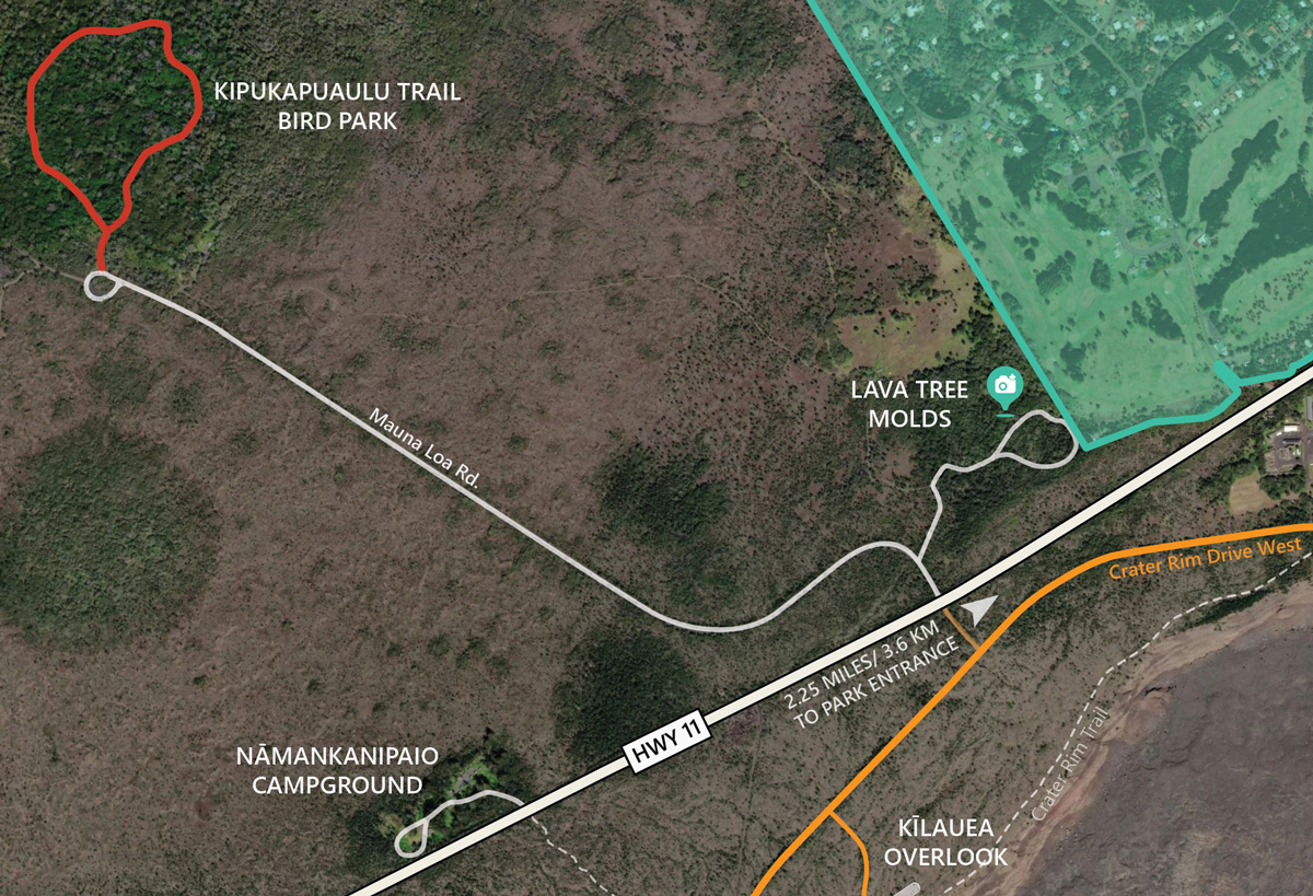
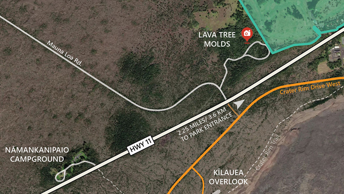
12. Lava tree molds
Lava tree molds are cavities in the lava where once a tree stood. As a lava flow engulfs a forest, it swirls around the water-laden tree trunks and hardens. Ultimately the tree bursts into flames, but the lava is solidified by now. Frozen in time, the tree mold left behind gives us a glimpse of the size of the trunks and the depth of the lava flow.
The Tree Molds site is off Mauna Loa Road, just a couple miles east of the Volcano National Park entrance. Follow the signs for Tree Molds, park at the end of the loop, and you will see the barriers fencing each tree mold.
YOUR ADVENTURE AWAITS